Learn
Alabama's Diverse Forests
Alabama is home to one of the United State's largest forests. Sixty-nine percent of the state is covered in forest land. That's over 23 million acres! Alabama doesn't just have a lot of trees, it houses some of the most diverse organisms in the United States as well. This is due to Alabama's many physiographic regions.
Alabama's Physiographic Regions
Alabama's basic physiographic regions include:
- Plateau – limestone valleys and uplands with rolling hills.
- Ridge and Valley – steep ridges with little to no soil and low productivity and fertile alluvial soils in valleys.
- Piedmont – gently rolling to steep topography with highly erodible, productive soils.
- Upper Coastal Plain – deep, well-drained soils with low fertility.
- Lower Coastal Plain – most of southern portion of Alabama characterized by sandy soils.
Physiographic Regions
Each of these regions is characterized by unique features. Physiographic regions are most commonly influenced by:
- Topography
- Soil
- Climate

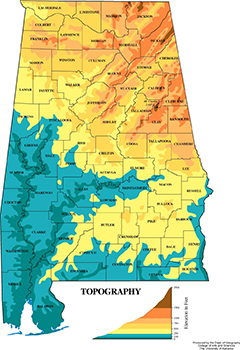
Topography
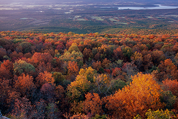
Topography describes the natural features of the land. These natural features are molded and shaped by natural occurrences over time. These topographic regions vary greatly as you work across the state. The northeast portion of the state sits at the foothills of the Appalachian Mountains while the southwest portion of the state consists of beautiful white sandy beaches. The land in between is equally as diverse and provides habitats for numerous forest types and organisms.
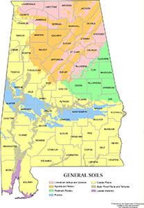
Soils
Alabama is home to six distinct soil areas, each with unique characteristics. Soil is the medium for plant growth and different plants and trees thrive in each of these diverse soils. This contributes to the many different trees that can be found across Alabama.
Soils are made up of four distinct compounds:
- Mineral particles
- Organic matter
- Water
- Air
Each soil's physical and chemical properties contribute to what trees will thrive in that habitat.

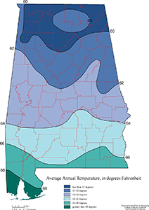
Climate
Climate is the third major contributing factor in Alabama's diverse forest types. The amount of precipitation and the average temperature in an area play key roles in the organisms that are present in a given environment.
Forest Types
Physiographic regions influence the forest types we have here in Alabama. The five major forest types are:
- Oak-hickory
- Oak-pine
- Loblolly-shortleaf pine
- Longleaf-Slash pine
- Oak-gum-cypress
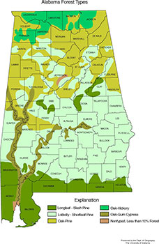
Oak-Hickory Forest
Oak-Hickory forests are located in the northernmost part of the state. These hardwoods are very resilient and tolerant to diverse climates. These trees are tolerant to fire, drought, and cold temperatures. These forests are home to various wildlife species as well due to the mast(fruit or nut bearing) producing trees.
Oak-Pine Forest
Oak-Pine forests serve as a transition from the oaks and hickories of the north to more pine dominated forest types. These trees are moderately tolerant to shade and often result from disturbances to the land.
Loblolly-Shortleaf Pine Forest
The loblolly-shortleaf pine forest consumes the largest area of the state and can be found commonly throughout a large portion of the state. This is due to its ability to establish and grow quickly making it ideal for landowners who want to have several harvests in their lifetime. These trees are also very tolerant to the hot temperatures in our state, plus they are very tolerant of fire, making them easier to manage.
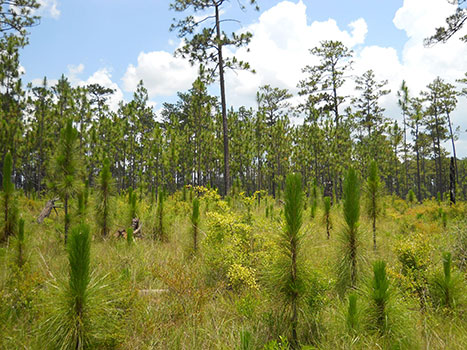
Longleaf-Slash Pine Forest
Longleaf and Slash pines do incredibly well in sandy soils which make them ideal for the southernmost part of Alabama as we transition to the beaches of Baldwin and Mobile county. They are also incredibly drought and heat tolerant.
Oak-Gum-Cypress Forest
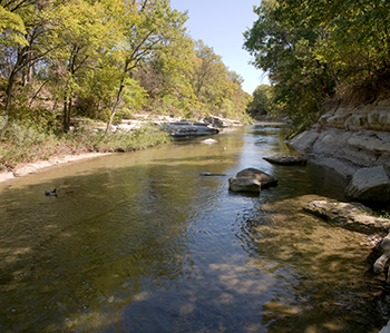
Oak, Gum, and Cypress forests are not as tolerant as our pine forests, but they can handle very wet, poorly drained soils. This means they can be found along our major waterways such as the Tombigbee and Alabama Rivers, which are tributaries of the Mobile River that flows into Mobile Bay.