Learn
Forestry Service History
Three Leaders
The National Forest System and the Forest Service divisions of the USDA was founded in 1905.
Three leaders were directly involved with establishing what would later become the Forest Service including:
- Franklin B. Hough,
- Bernhard E. Fernow, and
- Gifford Pinchot.
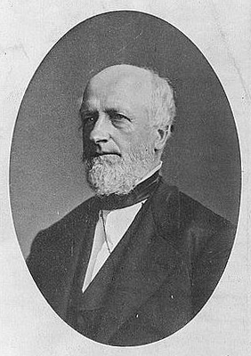
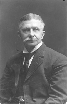
These men were the change agents to develop a new field of forestry with the interest of the preservation and conservation.
The leadership of Hough, Fernow, and Pinchot allowed for what we know today as the National Forest System to be established.
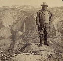
Teddy Roosevelt
In addition to Hough, Fernow, and Pinchot, Teddy Roosevelt was a willing advocate for the Forest Service. Roosevelt was an avid outdoorsman and therefore appreciated the forests. Since he was President of the United States from 1901 to 1909, his words and actions mattered.
Each of these leaders along with various scientific and conservation organizations, and newly trained forestry professionals, led the successful effort in retaining millions of acres of Federal forest land for future generations.
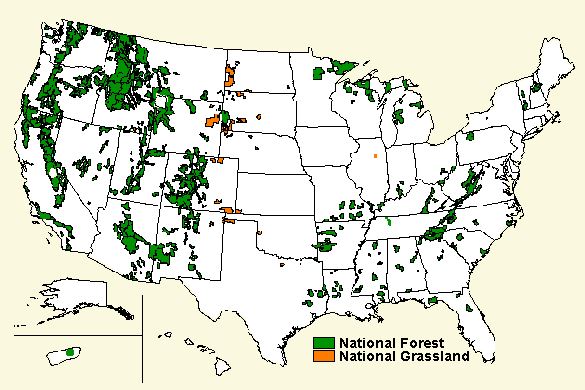
System Lands
Today the United States has a system of
- 155 national forests,
- 20 national grasslands, and
- 20 research and experimental forests.
There are also other special areas.
All of these together cover 191 million acres. As a group, these public domain lands are approximately the size of the State of Texas.
Employees
The Forest Service currently employee approximately 35,000 people and the various careers that people hold in this agency include:
- foresters
- engineers,
- firefighters,
- hydrologists,
- landscape architects,
- fisheries biologists,
- wildlife biologists,
- public affairs specialists,
- budget and financial administrators,
- human resource specialists,
- computer programmers,
- accountants,
- carpenters,
- mechanics,
- heavy equipment operators,
- and others.

Purpose
The main purpose of the USDA Forest Service it to ensure that forest land and grasslands are managed and maintained for a number of multiple uses.
These include timber, wilderness, recreation, minerals, water, grazing, and wildlife.
Alabama
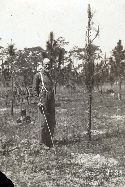
The Forest Service has four National Forests in Alabama that cover over 644,000 acres of land. The National Forests began in Alabama in 1914 with the National Forest Commission's Alabama Purchase Unit.
The first forest was located in Franklin, Lawrence and Winston Counties. Much of the ridge tops had been cut-over and approximately 40-percent of the land had been cut-over, cultivated and vacated farmland.
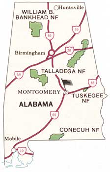
Let's look more closely at the history of Alabama's four National Forests.
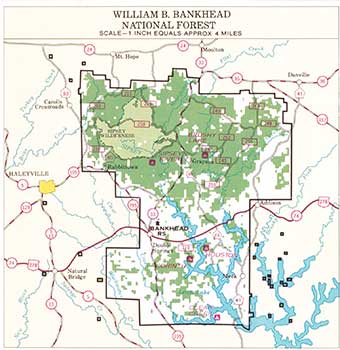
Bankhead National Forest:
According to the Forest Service, on June 19, 1936, by proclamation of President Franklin D. Roosevelt, the Alabama National Forest was renamed the Black Warrior National Forest.
The name was changed on June 17, 1942, by an Act of Congress, to the William B. Bankhead National Forest.
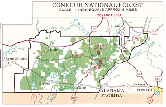
Conecuh National Forest:
The Forest Service website reports that the National Reservation Commission established the Conecuh Purchase Unit in Escambia and Covington Counties on January 21, 1935.
On July 17, 1936, the Conecuh National Forest was created by presidential proclamation.
The Conecuh National Forest initially contained 54,177 acres of cut-over and burned-over lands.
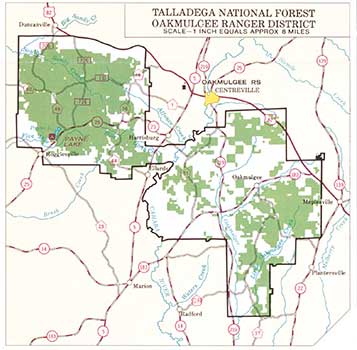
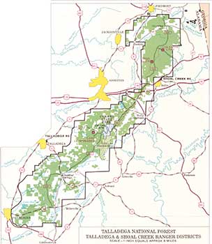
Talladega National Forest:
According to the Forest Service, the National Forest commission created the Oakmulgee Purchase Unit south of Centreville on January 21, 1935. When the area was first settled in the early 1800s, stands of timber were cleared for agricultural purposes and to build homes. What is now known as the Oakmulgee Ranger District was about 60 percent cut-over land.
On July 17, 1936, President Roosevelt, by proclamation, created the Talladega National Forest out of the Talledega and Oakmulgee Purchase Units.
At one time, the Talladega National Forest had four ranger districts: Oakmulgee, Tuscaloosa, Shoal Creek, and Talladega. The Talladega Unit was divided into two districts on October 1, 1945: Shoal Creek and Talladega. Thirty percent of the Shoal Creek/Talladega land was cut-over, cultivated, and vacated farmland.
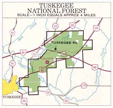
Tuskegee National Forest:
According to the Forest Service, the original project area was about 10,358 acres and was purchased by the federal government between 1935 to 1938. The purchase was authorized by the Bankhead-Jones Farm Tenant Act.
This program's objectives were to acquire eroded, worn-out farmland, resettle the occupants, and develop the newly purchased land for other uses such as forestry, wildlife, and recreation. Many other changes and actions occured prior to the area being proclaimed a national forst.
On November 27, 1959, the area was proclaimed the Tuskegee National Forest by President Dwight D. Eisenhower. Prior to federal government acquisiton, the area that is now the Tuskegee National Forest was one of the most abused, eroded wastelands in Alabama. The land was 80 percent cut-over.